Unlike other GPS applications, 68° gives you the option of creating two distinct types of route: stop-off points and waypoints. In this tutorial, we’ll explain how to use waypoints to fine-tune your route, avoid closed roads or construction zones, what mistakes not to make, and what you can do during guidance.
How to take a specific route
In this example, we want to link Lyon to Valence via the Nationale 88.
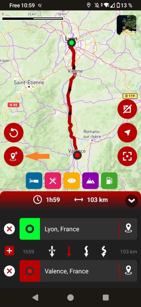
Click here to add a waypoint
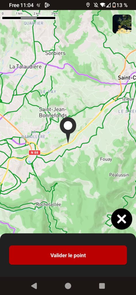
Position the point on RN 88
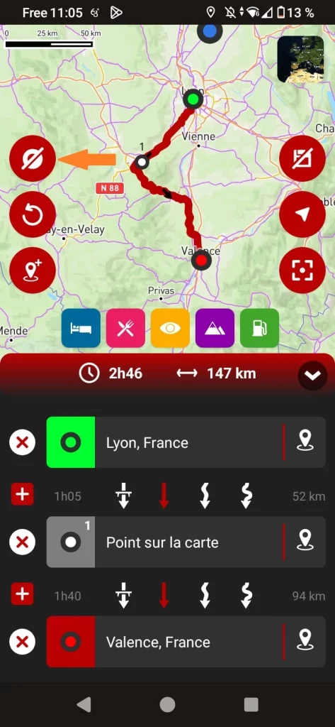
You can show or hide waypoints
Mistakes not to be made!
When placing a point on the map, it is strongly recommended that you zoom in as far as possible to ensure that the point is not on a road that would take you out of your way.
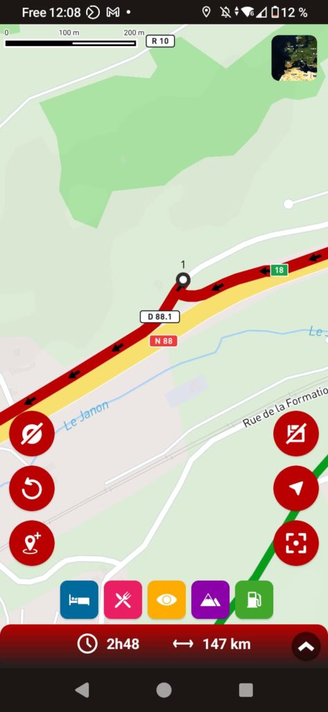
Here, the point has been accidentally placed on a parallel road, so the GPS would take you off the N88 and then back on.
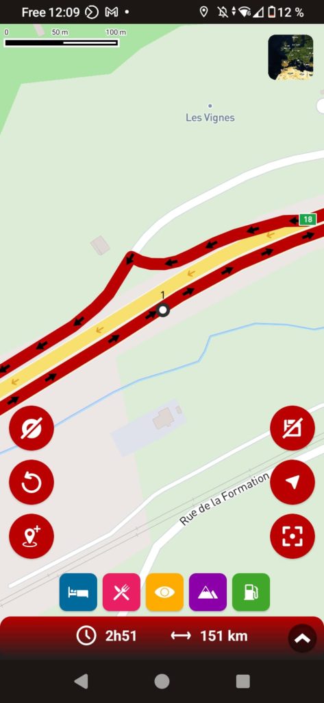
Here, the point is mistakenly located in the opposite lane. The GPS would then make a U-turn to take this lane, before returning to the normal trajectory. This is the most problematic case.
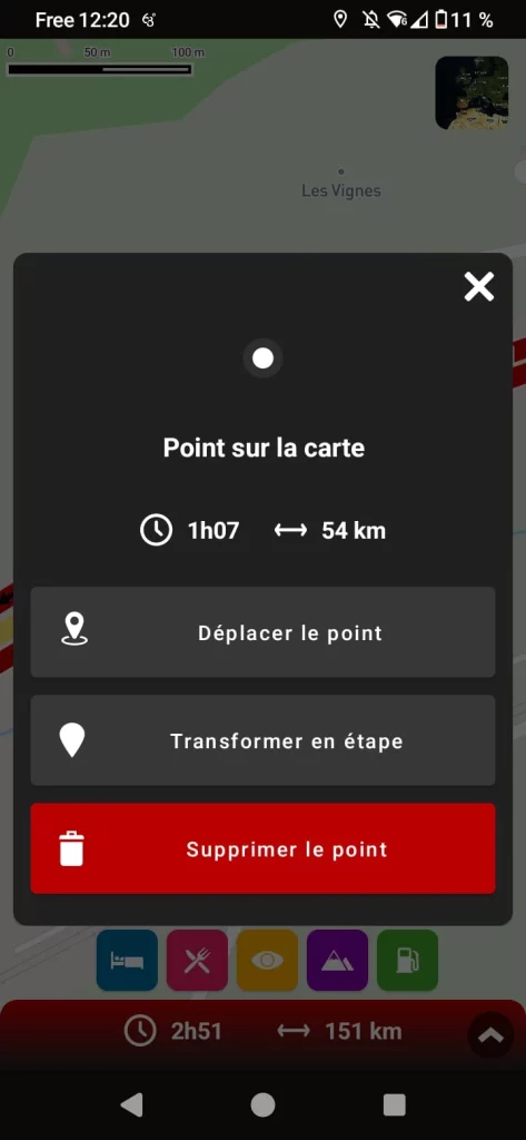
If, when zooming in, you notice that the point is causing a detour, you can easily reposition it by clicking on it.
How to pass near a city
If you would now like to add Le Puy-en-Velay to your itinerary to take advantage of the region’s winding roads, follow these steps
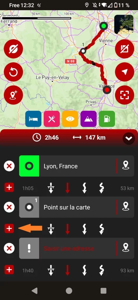
In the list of steps, click on the + button, making sure you’re in the right place.
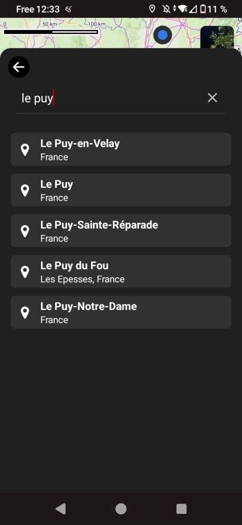
Use the search module to enter the name of the desired city.
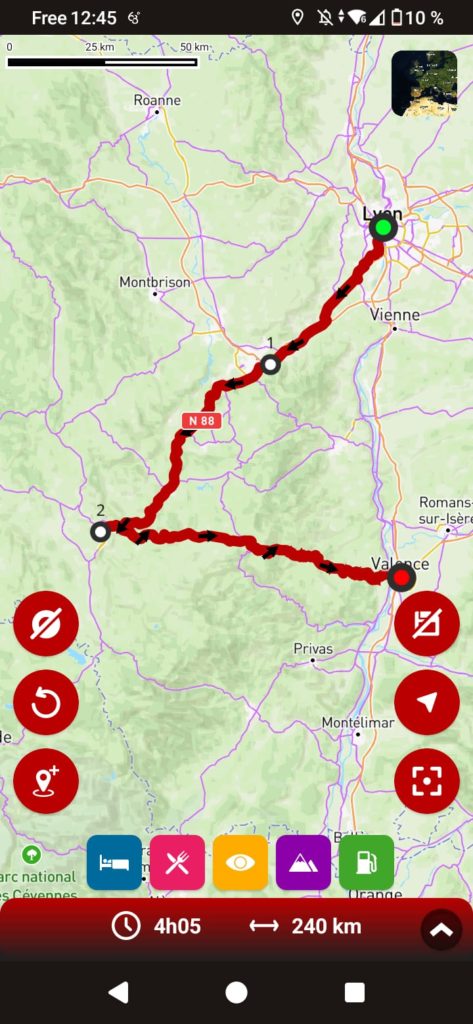
Once you’ve found the town you’d like to visit, confirm your choice to add it as a waypoint.
Fine, but!
As with any GPS, when you add a city to your itinerary, the search module systematically directs you to the city center. Since a GPS doesn’t understand the notion of “passing close by”, it will naturally guide you to the center, which is ideal for visiting the city, but inappropriate in our case.
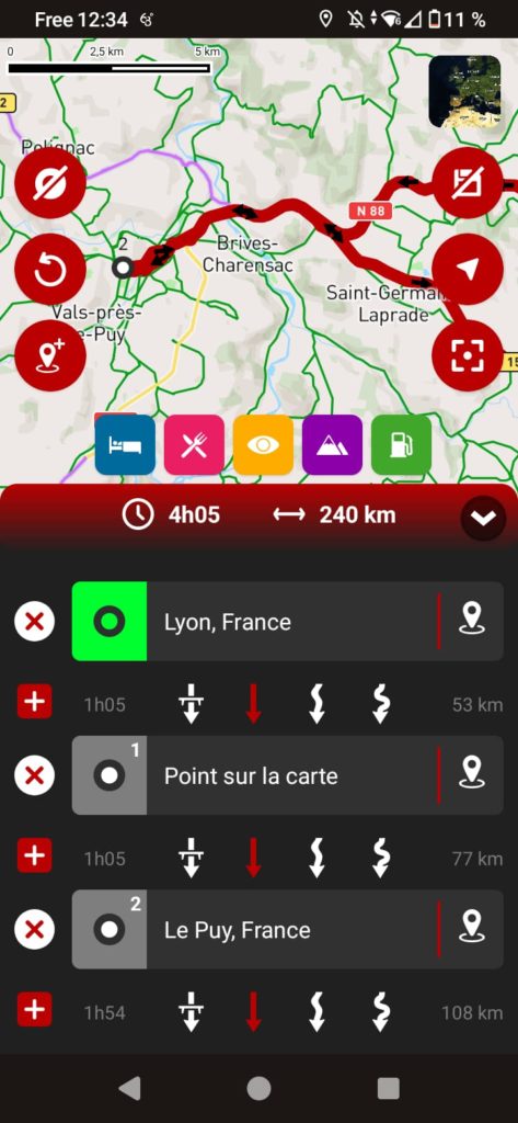
By adding Le Puy-en-Velay to the itinerary, the GPS will first take us to the city center before redirecting us to Valence.
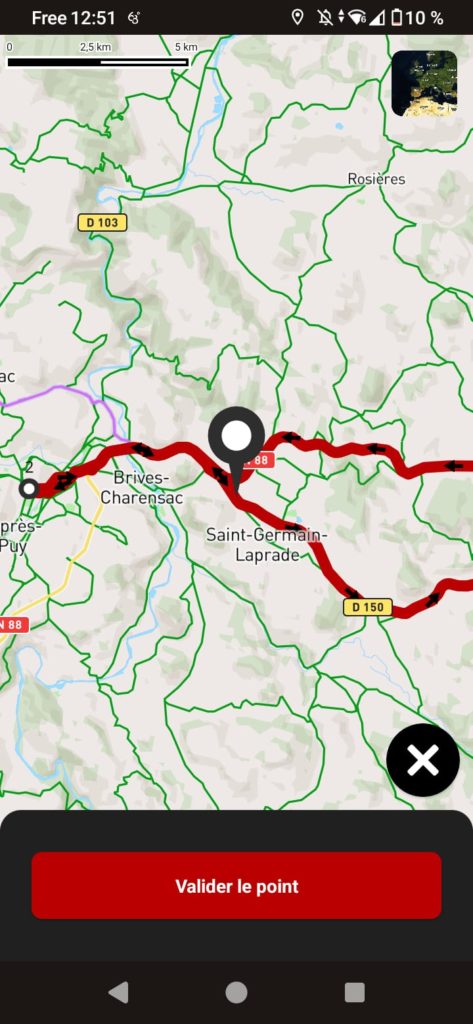
To avoid this, simply reposition the passage point to a more appropriate location.
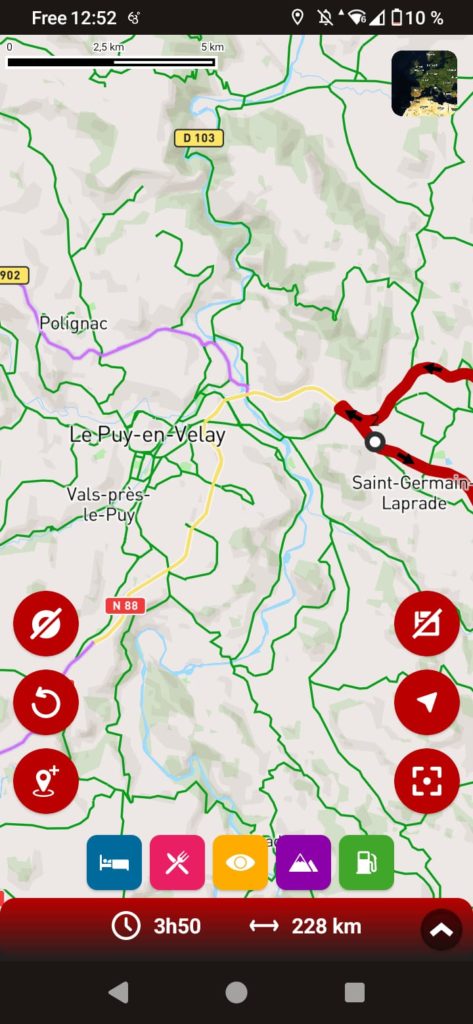
Once you’ve repositioned the point, don’t forget to zoom in to check that it’s correctly positioned.
How to avoid city crossings
Depending on the type of route selected between two stages or waypoints (freeway, winding roads, etc.), GPS can sometimes take you through towns when it would be preferable to bypass them.
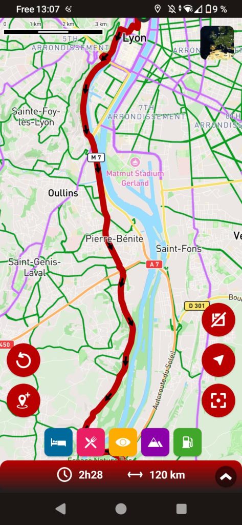
In this part of our itinerary, the GPS takes us through all the towns in the Lyon suburbs because we’ve chosen to avoid the freeway.
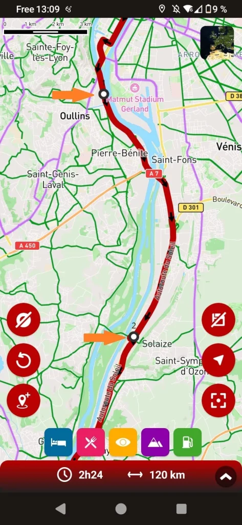
To avoid these crossings in the city, simply place two crossing points: one before and one after the urban area.
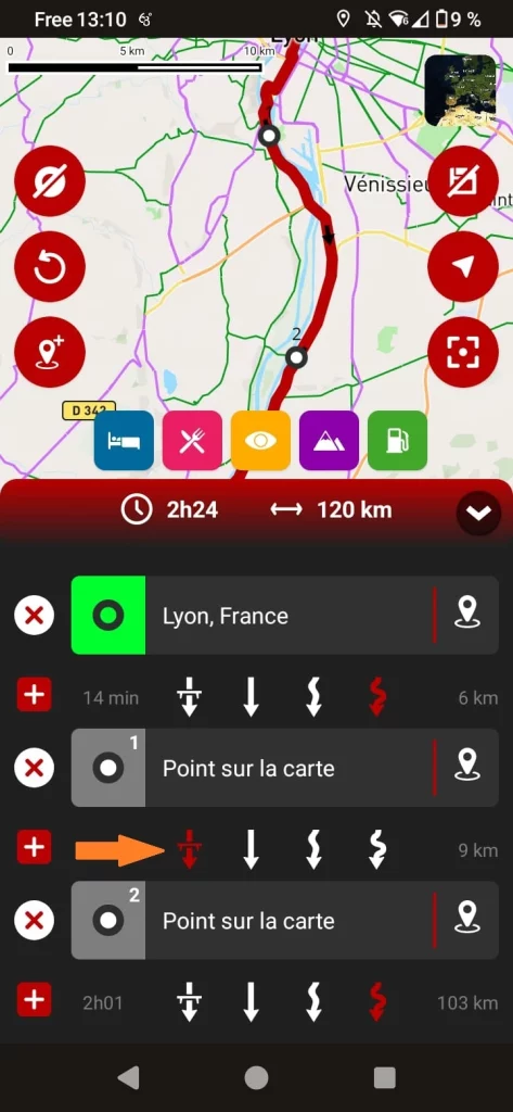
Then, by changing the type of road between these two points, the GPS will take you around the cities. Here, we’ve opted for a few kilometers of freeway
Avoiding a point while guiding
Once you’ve started guiding, the GPS will naturally take you through all the waypoints you’ve added to your route. However, there may be times when you need to “skip” a waypoint, for example if it’s on a closed road, or if you deviate from the route, intentionally or otherwise, and no longer wish to pass through it.
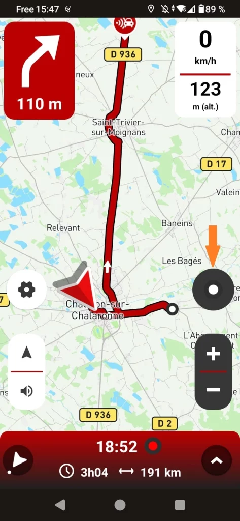
Click on the circle indicating the next step
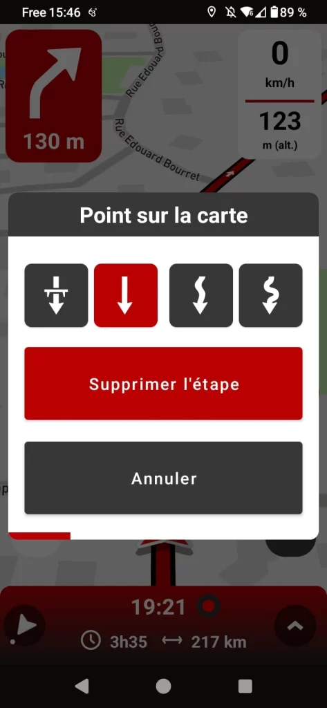
Select the “Delete step” option
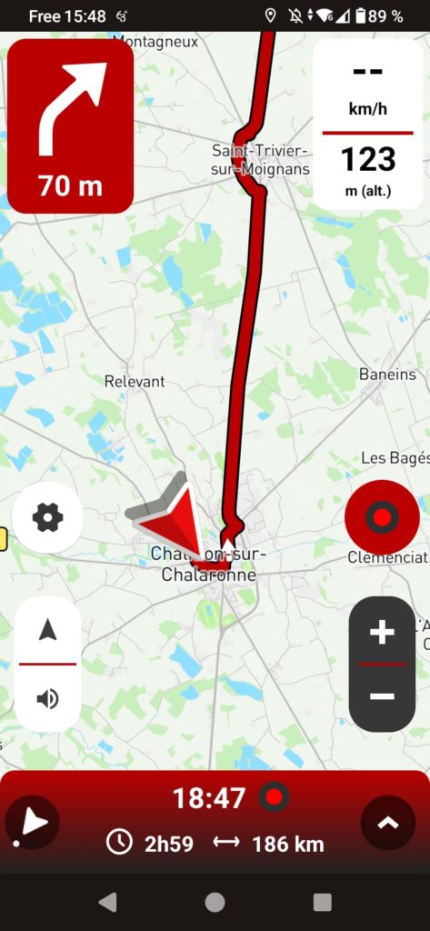
The route will then be recalculated without including this waypoint.
Add a point during guidance
You may also need to add a waypoint on the fly during guidance. This is the best way to bypass a construction zone with no detour indicated, to avoid a closed road or one-way street not listed on the map, or to add a recommended location during your journey. In our example, we want to avoid a road closed for roadworks. To do this, we’ll force the GPS to take another route by adding a waypoint.
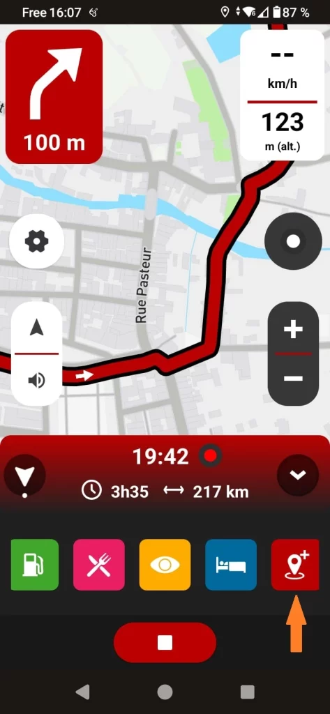
Click on the Point icon on the map
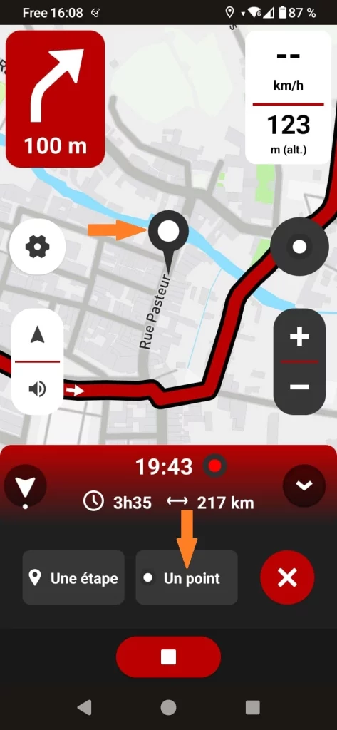
Position a waypoint on the desired route
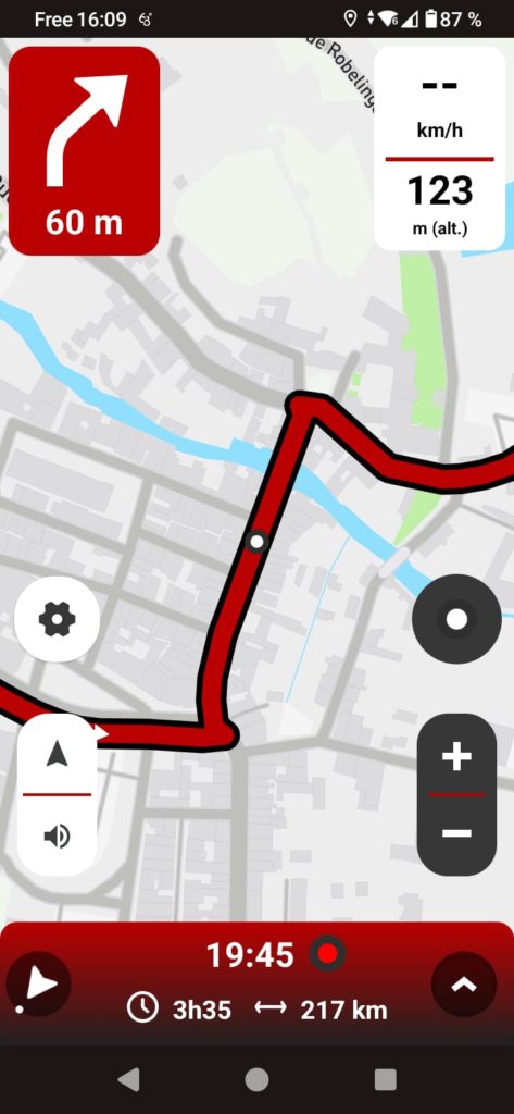
The GPS will then recalculate the route, avoiding the closed road.
To remember
Waypoints are extremely powerful tools for quickly designing customized routes, bypassing work zones, correcting mapping errors, and much more. However, misuse can lead to particularly frustrating guidance errors. To make the best use of them, be sure to check their exact position once the route has been generated. Avoid placing waypoints on freeways, expressways, one-way roads and in city centers, unless you absolutely must pass through a specific location in town.